Licensed Geodetic Engineer & 2D/3D AutoCAD Point Cloud Specialist
Belgrade,
Serbia
I am Milena, a licensed Master of Science in Land Surveying (M.Sc.Geod.) with over 10 years of professional experience in geodetic project management and precision CAD drafting. Ha...
Topographic plans, architectural designs, BIM, and LiDAR point cloud classification
Antananarivo,
Madagascar
With over 12 years of experience in LiDAR mapping, architectural plans with data acquired by the 3D laser scanner, and topographic plans in 2D and 3D, I am able to offer you my ser...
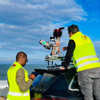
I am a surveying engineer (MSc in Geodesy) with hands-on experience on industrial, infrastructure and urban projects in Morocco and West Africa. I capture data myself (terrestrial...