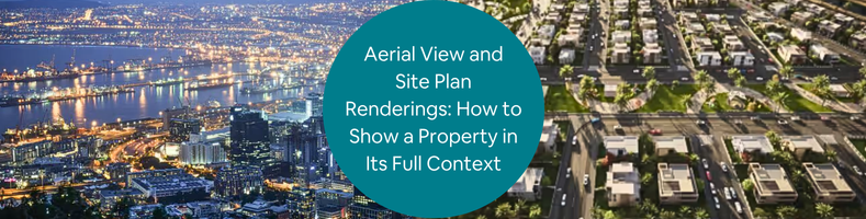
Aims and goals have been established in order to succeed. The renderings of the ground-level architecture aim to sell the building, while the aerial renderings sell the investment. A nice exterior perspective enables us to show and present what a property will look like, yet it is not always able to address the important questions that need to be answered before someone commits to a project. These questions include where the property is located, how close it is to commercial districts, schools, parks, public transportation, waterfront areas, major roads, and nearby developments, and what surrounds the site now and what might surround it in five or ten years. Through aerial view renderings and site plan renderings, it becomes powerful.
For developers, architects, and businesses preparing a property for presentation, Cad Crowd can connect you with experienced architectural designers and freelance 3D rendering professionals who can create detailed aerial and site plan renderings. These visuals can help communicate the property’s full context and give clients and investors a clearer understanding of the project before construction begins.
RELATED: How to Build a Real Estate Portfolio Using 3D Renderings & Visualization Services
🚀 Table of contents
What are aerial property renderings?
Definition and its role
An aerial property rendering is a visual representation of a development that is viewed from above, or from an elevated perspective. Instead of the common architectural renderings that are taken from street level, the aerial image enables you to present the property and, at the same time, the surroundings. As with the project’s requirement, it does matter and depends on whether the image can just cover the immediate site needed or several blocks, the neighborhood, and the larger geographic area.
Significance and its application
With the use of the aerial view, it will be efficient to communicate especially in showing the property’s relationship to the highways, and major roads, the distances from the airports, train stations, and transit stops, the proximity to beaches, rivers, lakes, and other natural features, as well as with the nearby retail, schools, restaurants, hospitals, offices, the neighboring properties, landscaping and open spaces, the future developments, and the construction phases, and the overall site accessibility. For projects where location is a component of the selling proposition, this more comprehensive viewpoint is particularly helpful.
Why context matters in real estate visualization?
Context and value
A property does not exist alone; it is being influenced by what surrounds it. The value of the property can be impacted by various reasons. An example of this is that a development that is near a highway can have various advantages and disadvantages compared to one that is in a quiet residential district. A resort with a view of the ocean has a different selling point than a hotel close to an airport. There could be a lot of potential in the future for a mixed-use development surrounded by new infrastructure. The aerial design visualization services can highlight the connections.
RELATED: Architectural Photorealistic Rendering: Why Visualization Services Are Essential
Benefits for investors and buyers
For the investors, the aerial renderings can help in a way that it can communicate the potential developments, the accessibility, the market positioning, as well as the relationship between the proposed project and its surroundings. As well as, for the buyers, the location can be a big advantage for easy understanding. Rather than completely reading descriptions such as the property is close to nearby hotels, restaurants, and public transportation, it is difficult to visualize. But with the use of aerial visualization, it can be easier to see that the destination is in line with the developments.
On the other hand, the aerial and site plan images can help zoning officials and planning authorities understand how a proposed development interacts with nearby roads, properties, pedestrian routes, public areas, and infrastructure. Hence, a more comprehensive narrative is the outcome. “What will the property look like?” is addressed by a ground-level rendering. “Where does this property fit?” is addressed by an aerial rendering. By providing an answer to the question, “How will the entire development work?” a site plan rendering goes one step further.
Two ways to create an aerial rendering
In aerial property visualization, there are two major production approaches that are being utilized. One is through drone photography composites, and the other is Full CGI aerial renderings. These two approaches can produce convincing results, but they can show differences in various situations and contexts.
RELATED: Property Rendering Tips: 7 CGI Techniques That Make Real Estate Listings Stand Out
1. Drone photography composites: maximum realism
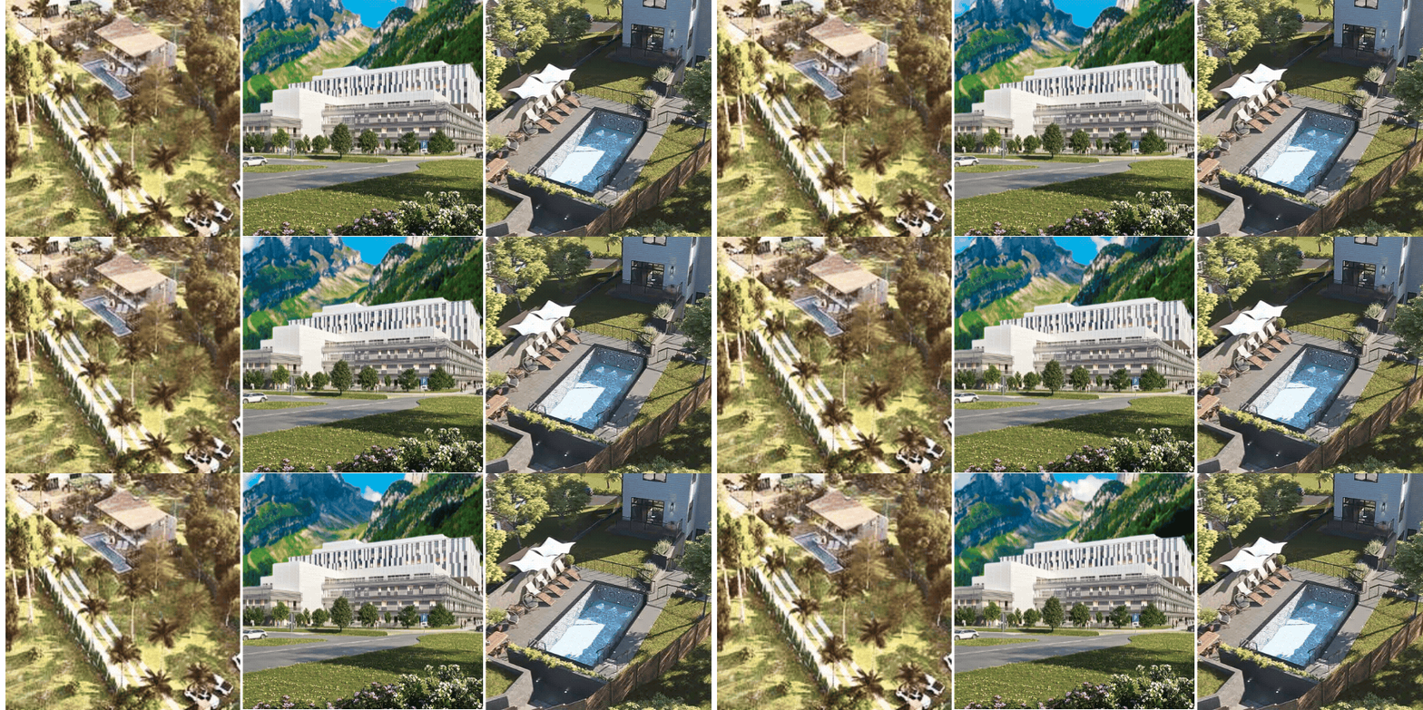
A drone composite does begin with the real aerial photograph of the property. A licensed drone pilot is responsible for capturing what an existing site is based on the appropriate altitudes and angles. In comparison, the freelance architectural visualization team can integrate the proposed buildings or even the development into the photograph.
The workflow typically looks like this:
- Real site
- Drone photography
- 3D building model
- Camera matching
- Lighting matching
- Compositing
- Final aerial rendering
The biggest advantage of it is the realism. The photograph can depict what the surrounding environment will look like. Even the roads, trees, nearby structures, utility infrastructure, topography, parking lots, and other visual components can be taken from the actual site.
- Aligning the camera
One of the most crucial steps in the overall procedure is the matching and aligning of the camera. The drone photo and the 3D model design services need to be positioned from the same angle. The building may appear to have been pasted onto the picture if the camera angle, focal length, height, or perspective are all off. Experts such as visualization artists can examine the source image and replicate its camera properties in a three-dimensional setting.
RELATED: How Property Developers Use 3D House Rendering Services to Help Reduce Costs & Boost Sales
- Matching the sun and shadows
Lighting is a big contributing factor that must be matched. If the drone photograph presents the long shadows that extend towards the east, the building in the CGI should be producing shadows, making it consistent within that direction. The artists can replicate the approximate time of day, sun position, cloud cover, and general brightness, and other needed components. A composite may appear artificial due to even minor discrepancies
- Matching the atmosphere
The final step must involve matching the atmospheric characteristics, and that includes the haze, the sky conditions, the contrast, color temperature, atmospheric perspectives, the reflections, exposure, as well as the appearance of the vegetation. When all of these elements are utilized properly and rightly, the proposed building cannot be recognized from the real existing environment.
When do drone composites work best?
Drone composites are effective, especially when they are used correctly, such as when the site is accessible for aerial photography, the presentation depends on the surrounding environment, the scenery is eye-catching, the developer desires the highest level of realism, the current surroundings are comparatively stable, and the buyers who need to know the precise location are being marketed the project. The reliance of the project on the actual site may face a primary drawback. If flying over the property is neither safe nor permitted, it may be difficult to obtain suitable photography.
RELATED: How 3D Exterior Visualization Showcases Architectural Projects for Design Firms
2. Full CGI aerial renderings: complete control
The next approach would be to create and build a digital aerial environment. Rather than beginning with the drone photograph, the artists are able to make a 3D environment with the available information such as the survey data, the CAD drawing services, GIS information, the mapping data, satellite imagery, the terrain data, the footprints of the building, the road networks, as well as the information of the existing sites.
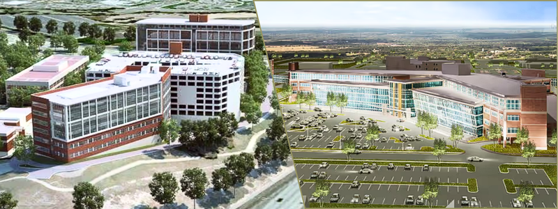
The main benefit of using a full-CGI rendering is that the rendering team has complete control over the image. Seasons, time of day, weather, vegetation, surrounding buildings, traffic, landscaping, and more can all be altered to best suit the needs of the client. Full-CGI renderings are incredibly beneficial for developments that will change over time. A drone photo may show an empty site, but a full-CGI rendering can show the potential for that site in the future.
- Showing the development phases
There are a lot of developments that are completed in phases over the past years. This means that an investor or buyer may only be able to see the project as it is being built or see an empty site. With renderings, a visualization team can show what the development looked like before, during, and after the development period. Associating and utilizing these types of renderings enables the clients and buyers to understand the full scope of a project.
RELATED: Creating Exterior Renderings Using 3D Exterior Rendering Services for Architects
- Aerial vs. site plan
At first glance, all of the aerial and architectural site plan services may look similar, but they are not; they often serve very different purposes. An aerial rendering focuses on the property and its surroundings. Because an aerial rendering can be so realistic, it may even look like a photo that was taken by a drone. A site plan, on the other hand, is more about showing the organization of the development.
A site plan rendering may use a bird’s-eye view, but the graphics may be simplified for the viewer. The information shown in a site plan rendering may include property lines, individual building footprints, roads, driveways, sidewalks, parks, pools, clubhouses, landscaping, traffic patterns, utilities, and much more. Overall, the aerial rendering can make it possible for the viewers to see the property and its surroundings, while a site plan shows the viewer the organization of the development.
Why are site plan renderings important?
Many large-scale developments require an extensive amount of planning before any ground is broken. This usually entails that there will be a site plan involved. A site plan is usually complicated, and it may include a lot of notes, measurements, symbols, and other information. This information is incredibly important for engineers and planners, but it can be difficult for buyers, investors, and others to understand. A rendered site plan can help clarify the information by adding buildings, landscaping, roads, and other familiar elements. A rendered site plan can make a complicated series of drawings much more accessible to a buyer or investor.
Imagine a master-planned community that includes hundreds of residential lots, a clubhouse, pools, parks, trails, retail, a school, and several roadways. These types of developments can be incredibly difficult to understand when looking at a technical plan, but a rendered site plan can help clarify the layout of the development. Because of this, a rendered site plan can become a valuable marketing tool for a development. It can be used in sales centers, on websites, in presentations, to investors, and more.
RELATED: Realistic Exterior Rendering: Here’s How 3D Artists Design Precision Renders for Your Company
The low-angle site plan renderings
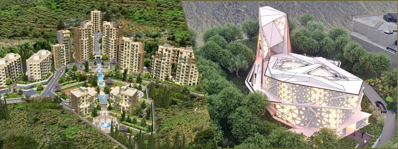
Not all site plan renderings are done from a bird’s-eye view. There are still individuals who use a lower angle to show off the development while still keeping the familiarity of a site plan rendering. This allows a rendering team to create something that looks similar to an architectural rendering services while still keeping the wider perspective of a site plan rendering. Instead of looking at building footprints, the viewer can see building facades, trees, and more. This can be a great option for residential developments, resorts, mixed-use projects, commercial developments, and more.
Showing the development phases
Many large-scale developments are built in phases over the course of several years. Because of this, one rendering may not be enough to show what a buyer or investor can expect. A freelance visualization design team may create a few renderings that show different phases of the development.
The first image should show what has already been built, while the second image may show what has yet to be built. One option is to create a before-and-after rendering, in which it would explain that one image will show what the site looked like prior to the development and the second image will show what the development can be expected to look like in the future.
RELATED: The Best 5 Angles for Architectural Exterior Rendering to Showcase Building Projects
What are aerial and site plan renderings for?
Zoning authorities may have their own concerns when looking at a rendering. They may be more concerned with the relationship between the development and the surrounding buildings, roadways, and natural landforms. A clear and concise aerial or site plan rendering services can help them see the project as clearly as possible for meetings and presentations.
Buyers and future residents are likely to be concerned with what they will be able to see and do when the project is completed. They may care about how far the nearest highway is or how close the nearest park is. An aerial rendering can show them all of these things at a glance. It can show them the value of a master-planned community and where their home or lot may be located in relation to other buildings.
Typical cost of aerial and site plan rendering services
| Rendering Service | Typical Cost | Best For |
|---|---|---|
| Basic exterior rendering | $1,400–$2,800 | Building exteriors and simple surroundings |
| Aerial property rendering | $1,500–$3,000+ | Showing the property and surrounding area |
| Site plan rendering | $1,000–$2,500+ | Residential and commercial developments |
| Detailed aerial CGI | $2,000–$4,000+ | Large properties with detailed surroundings |
| Drone photo + CGI composite | $1,500–$3,500+ | Existing sites requiring photorealistic context |
| Large development/master plan | $3,000+ | Communities, resorts, parks, and mixed-use projects |
| 360° exterior/panorama | $1,500–$2,500 | Interactive property presentations |
What to give the rendering team?
The more information that is given to a rendering team, the more accurate the rendering will be. The following information can be helpful to a rendering team: Site plan CAD files, survey information, drone photography (if available), architectural models, landscaping design services, development phasing information. Hence, the more accurate this information is, the more accurate the rendering will be.
RELATED: Full Guide: Commercial Architectural 3D Rendering Services for Companies & Firms
Aerial views tell a bigger story
A building can look nice in an architectural rendering, but it does not always tell the full story. An aerial rendering shows the property in a larger perspective. It shows the value of a development by placing it in context with the surrounding area, amenities, and more. It helps buyers and investors understand what this development can offer. In other words, while an architectural rendering can show the beauty of a building, an aerial rendering design services can show the opportunity of a development.
Drone vs. CGI
There are two options when it comes to the topic of aerial renderings: the drone composite and the full CGI rendering. A drone composite is a better option when the site is accessible to people, the surrounding area is desirable, it is really important to have photorealism, and high-quality aerial photography is available. A full-CGI rendering is a better option when the site is inaccessible or undeveloped, the surrounding area is undesirable or will change, there is a need to show different time periods, and more control is needed.
The two options can also be combined. A drone photo can provide a realistic image of the world while CGI can be used to add buildings, landscaping design services, and more. This allows a rendering team to show buyers and investors the current state of the world while also showing them the future potential of the development.
The value of a strong site plan
By utilizing or having a strong site plan, it can offer a benefit to both the buyers and the planners. For the sales teams, a strong site plan rendering is helpful, as it can make the development easier to understand, which can help it stand out from the competition. On the other hand, for the planners and officials, it can show them how the development would fit together and how it would relate to the world around it. As for everyone else, it enables us to show what the finished development would look like and how it will change the region. This versatility makes it a valuable tool for residential, commercial, hospitality, mixed-use, and industrial projects, as well as for large-scale master-planned developments.
Conclusion
A property is more than just a building. It is part of a much larger world that includes roads, other buildings, natural landforms, and more. An architectural rendering can show the beauty of a building, but it does not always show the value of a development. Aerial and site plan renderings show the bigger picture and allow buyers, planners, and more to understand the potential of a development.
Drone composites are a great option when the site is accessible, the world around the development is desirable, and photorealism is needed. Full-CGI renderings are a better option when the site is inaccessible or undeveloped, the world around the development is undesirable or will change, and more control is needed. Site plan renderings help buyers understand the development and help planners understand the development’s impact on the world around it. In the end, an aerial or site plan rendering is about telling the story of a development and showing its potential. Connect with vetted freelancers in Cad Crowd to help you with either aerial or site plan renderings with confidence.
RELATED: Best Practices for Architecture Firms: Residential and Commercial Architectural Site Planning
How Cad Crowd can help
Cad Crowd connects developers, architects, and businesses with vetted 3D rendering professionals who can create aerial views, site plan renderings, drone composites, and full-CGI visuals. These experts can help showcase a property’s surroundings, layout, and future potential, making projects easier for buyers, investors, and planners to understand. Contact Cad Crowd today for a free quote.