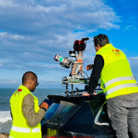
Land Surveyor specialized in LiDAR and photogrammetry post-processing, delivering accurate and engineering-ready terrain data for civil engineering and infrastructure projects.
I...
Surveying Engineer with 15+ Years of International Experience in Geodetic, Infrastructure, and Industrial Projects
I am a surveying engineer with over 15 years of experience in ex...
Geomatics Technician with solid experience in technical assistance to civil engineering projects.
I have several years of experience working with AutoCAD applied to engineering.
De...
I am a surveying engineer (MSc in Geodesy) with hands-on experience on industrial, infrastructure and urban projects in Morocco and West Africa. I capture data myself (terrestrial...
CAD Drafter | AutoCAD & Civil 3D | Survey Data Processing | Area & Volume Calculations
Jaipur,
India
I provide remote CAD drafting, survey data processing, quantity calculations and technical documentation support.
I work with AutoCAD, Civil 3D and Microsoft Excel and can handle t...
· 15+ years of drafting experience in Land Surveying, Engineering, Architectural, and Structural.
· List of Programs I am proficient in and have 5 to 10 years working with
· Auto...
Land Survey CAD Drafting Specialist | Boundary • ALTA • Topo • Subdivision Survey CAD Drafter
Pune,
India
Accurate drawings build trust. In land surveying, CAD drafting is where field data becomes decisions, approvals, and construction-ready plans.
I am a Survey CAD Drafting Specialis...