I am an experienced civil engineer in contracting with mega size companies in the gulf region. I am experienced in project management and able to do contracting works from A to Z i...
· 15+ years of drafting experience in Land Surveying, Engineering, Architectural, and Structural.
· List of Programs I am proficient in and have 5 to 10 years working with
· Auto...
Revit & MicroStation Drafting Specialist | BIM, Infrastructure, Scan to BIM & Point Cloud Expert
Bangladesh
Civil Engineering graduate with hands-on experience in BIM, GIS, and point cloud processing for architectural and infrastructure projects, including Netherlands-based work.
Skille...
3ds Max with vrayArcGIS ProArchitectural 2D CAD DraftingArchitectural BIM Modeling24
more
Senior Civil 3D Road Designer, Grading, Drainage, Earthwork & Quantity
Phnom Penh,
Cambodia
I help engineering firms and land developers transform survey data and design concepts into accurate Civil 3D models and construction-ready drawings.
With 10+ years of civil infra...
FAM Civil & Structural Services Architectural & Design Engineering Consultancy.
OUR Mission
Enhance the capability of the Construction Industry through applications of Modern T...
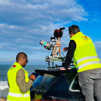
I am a surveying engineer (MSc in Geodesy) with hands-on experience on industrial, infrastructure and urban projects in Morocco and West Africa. I capture data myself (terrestrial...
Licensed Civil Engineer with 15 years of experience in land development which includes master planning, site, stormwater, water, sewer, grading, erosion control, and transportation...