arcGis Designers
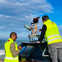
Surveying Engineer | Scan to BIM, Point Cloud to Revit & AutoCAD | Civil 3D | Drone Mapping
- Portfolio: 2
- Rabat, Morocco
I am a surveying engineer (MSc in Geodesy) with hands-on experience on industrial, infrastructure and urban projects in Morocco and West Africa. I capture data myself (terrestrial...
Software related to arcGis
- 2D & 3D Modeling Solidworks
- 2D AutoCAD
- 2D/3D AutoCAD
- 3D Max
- ArcGIS
- Auto CAD/Revit
- AutoCAD
- Autodesk Autocad
- Autodesk Autocad civil 3d
- Autodesk Storm & Sanitary Anal
- Google Earth Pro
- HEC-HMS Hydrologic Modeling Sy
- HEC-RAS Hydrologic Engineering
- HECRAS
- Microsoft Excel
- Photopea
- QGIS
- SketchUp
- XPSWMM
- iqgeo