Topographic Mapping Services Designers

Topographic plans, architectural designs, BIM, and LiDAR point cloud classification
- Antananarivo, Madagascar
With over 12 years of experience in LiDAR mapping, architectural plans with data acquired by the 3D laser scanner, and topographic plans in 2D and 3D, I am able to offer you my ser...

A team of AutoCAD, AutoCAD Cvil 3D, ArcGIS, Google Earth designers
- Portfolio: 1
- Peshawar, Pakistan
I have over 15 years of experience as a skilled Civil Engineer and possess expertise in using Auto CAD, Civil 3D, and Microsoft Excel. My abilities include creating 2D drawings for...
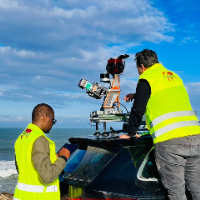
Surveying Engineer | Scan to BIM, Point Cloud to Revit & AutoCAD | Civil 3D | Drone Mapping
- Portfolio: 2
- Rabat, Morocco
I am a surveying engineer (MSc in Geodesy) with hands-on experience on industrial, infrastructure and urban projects in Morocco and West Africa. I capture data myself (terrestrial...
Software related to Topographic Mapping Services
Skills related to Topographic Mapping Services
- 2D Layout Design
- 3D Architectural Rendering
- Bathymetric Survey
- CAD Design
- CAD Drawing
- Civil 3D
- Design Storm Network
- Drafting
- GIS
- GIS Mapping
- Google Earth Pro
- Real estate
- Road & Highway Drafting
- Sections
- Subdivision Plan Creation
- Survey Drawing
- Survey Topography
- Topographic Maps
- Topographic Plans
- Volume Calculation