Land Survey Drafting ,LiDAR data and GIS specialist
Bhubaneswar,
India
I can support for drafting services and different GIS & CAD projects (Survey Mapping, Structural, Architectural design, Structural calculations). We are expert for drafting for Bo...
I am an experienced Land Surveyor and GIS & UAV Mapping Specialist with extensive field experience in land surveying, topographic mapping, drone mapping, CAD drafting, and geospati...
New Residential, Autodesk Navisworks & AVEVA PDMS Specialist
Hyderabad,
India
over 15+ years of experience in CAD/ GIS/ Lidar / BIM( Arch, MEP) /PDMS Industry verticals.
-Architecture, Engineering & Construction (AEC) Solutions
-Mechanical (Industrial...
I am a Civil 3D and CAD specialist with over 22 years of experience in topographic mapping, digital terrain modeling, and civil infrastructure documentation. My career spans full-c...
Qualified Engineering Surveyor with 5years experience in mapping and engineering surveys. He is well versed with Total Station Survey, RTK GPS Survey and post-processing of survey...
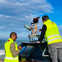
I am a surveying engineer (MSc in Geodesy) with hands-on experience on industrial, infrastructure and urban projects in Morocco and West Africa. I capture data myself (terrestrial...
Civil 3D and CAD specialist with strong experience in detailed topographic mapping, digital terrain
Russia
I am a Civil 3D and CAD specialist with over 25 years of experience in topographic mapping, digital terrain modeling, and civil infrastructure documentation. For the past 7+ years...
AutoCADAutoCAD Raster DesignAutodesk Civil 3DBIM Credo Topoplan16
more
I have 12 years of professional experience in GIS mapping, survey drafting, and geospatial data processing. I help clients turn raw survey and spatial data into accurate, easy-to-u...
Hi, I am Datta.
I am a professional Civil Engineer and GIS Specialist with over 10 years of experience in land surveying, architectural planning, and CAD drafting. My expertise li...