I am a Land Surveyor based in Nanyuki, Kenya working with Cornerstone Geo Tech. I specialize in CAD drafting, cadastral file compilation, GIS mapping, mutation layouts, field diagr...
Civil design and drafting, Survey drafting, GIS mapping.
Oklahoma City,
OK,
United States
10 years of experience working with Autocad Civil 3d. 7 years in water and sewer project development and 3 years in a land surveying firm specializing in pipeline easements, constr...
Hello!I am a survey engineer,i can design or calculate many projects for you in construction field,also i can plan and analyze datas or creating maps according the purpose you need...
New Residential, Autodesk Navisworks & AVEVA PDMS Specialist
Hyderabad,
India
over 15+ years of experience in CAD/ GIS/ Lidar / BIM( Arch, MEP) /PDMS Industry verticals.
-Architecture, Engineering & Construction (AEC) Solutions
-Mechanical (Industrial...
I am a Civil 3D and CAD specialist with over 22 years of experience in topographic mapping, digital terrain modeling, and civil infrastructure documentation. My career spans full-c...
Qualified Engineering Surveyor with 5years experience in mapping and engineering surveys. He is well versed with Total Station Survey, RTK GPS Survey and post-processing of survey...
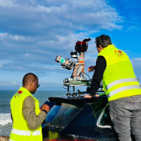
I am a surveying engineer (MSc in Geodesy) with hands-on experience on industrial, infrastructure and urban projects in Morocco and West Africa. I capture data myself (terrestrial...
Civil Engineer with 2+ years of experience in land surveying, DGPS operations, AutoCAD drafting, and GIS mapping. Specialized in survey layouts, contour mapping, site execution, an...
Civil 3D and CAD specialist with strong experience in detailed topographic mapping, digital terrain
Russia
I am a Civil 3D and CAD specialist with over 25 years of experience in topographic mapping, digital terrain modeling, and civil infrastructure documentation. For the past 7+ years...
AutoCADAutoCAD Raster DesignAutodesk Civil 3DBIM Credo Topoplan16
more