Topographic Survey Designers

Civil 3D and CAD Specialist | Topographic Mapping, Digital Terrain Modeling & Survey Data Processing
- Portfolio: 8
- Helsinki, Finland
I am a Civil 3D and CAD specialist with over 22 years of experience in topographic mapping, digital terrain modeling, and civil infrastructure documentation. My career spans full-c...
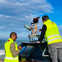
Surveying Engineer | Scan to BIM, Point Cloud to Revit & AutoCAD | Civil 3D | Drone Mapping
- Portfolio: 2
- Rabat, Morocco
I am a surveying engineer (MSc in Geodesy) with hands-on experience on industrial, infrastructure and urban projects in Morocco and West Africa. I capture data myself (terrestrial...

Expert Civil Drafter | 5+ Yrs Oil & Gas | Subdivisions & HDD Design
- San Antonio, TX, United States
With over 5 years of specialized experience in the Permian Basin and across Texas, I provide high-precision drafting and design services for the energy and land development sectors...
Software related to Topographic Survey
- Agisoft Metashape
- ArcGIS Pro
- AutoCAD
- AutoCAD Civil 3D
- Autodesk Civil 3D
- Autodesk Infraworks
- Autodesk Navisworks
- Autodesk Revit
- CloudCompare
- DJI Terra
- HydroCAD Stormwater Modeling
- Infraworks
- Leica Cyclone 3DR
- Leica Cyclone Register 360
- MS Office
- Pix4D
- QGIS
- Trimble Business Center
- Trimble RealWorks
- covadis
Skills related to Topographic Survey
- 2D Drafting
- 3D Models
- As-Built Drawings
- BIM Modeling
- CAD Conversion
- CAD Design
- Civil Drafting
- Civil Engineering
- Construction Documentation
- Construction Drawings
- GIS Mapping
- MEP Drafting
- PDF to CAD Conversion
- Quantity Takeoff
- Revit Modeling
- Road Design
- Scan to CAD
- Site Plans
- Volume Calculation
- civil 3d corridor modeling