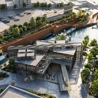
I am a dedicated Civil Engineering Technologist and CAD Specialist with a focus on high-precision architectural drafting and photorealistic 3D visualization. With a professional ba...
Professional Civil engineer with
-10+ years experience in Civil design of roadways, site development and utility design for water, sewer, storm, and other utilities (electric, ga...
Licensed Geodetic Engineer & 2D/3D AutoCAD Point Cloud Specialist
Belgrade,
Serbia
I am Milena, a licensed Master of Science in Land Surveying (M.Sc.Geod.) with over 10 years of professional experience in geodetic project management and precision CAD drafting. Ha...
GIS professional with 6 years of Civil 3d design experience.
Ogden,
UT,
United States
MBA-backed Geospatial Solutions Architect and Design Leader with over 10 years driving enterprise GIS strategy and 16 years of military intelligence expertise. Proven track record...
2D & 3D Conceptual Design2D AutoCAD drafting PDF3D Surface Modeling3D pipe modelling15
more
🏗️ Precision Meets Creativity: Civil Engineering, Surveying, CAD Drafting & Copywriting Expert
Hi! I am a multi-skilled professional with over 10+ years of experience in Civil Eng...
2D & 3D Architectural Design2D & 3D Modeling Solidworks2D House Design2D/3D AutoCAD20
more
Architect and AutoCAD specialist based in Bogotá, Colombia, with over 10 years of professional experience in planimetric digitization, technical drawing production, and constructio...
Civil 3D | Land Development | Grading & Drainage | Site Plans | CAD Drafting
San Jose,
CA,
United States
I am a Civil CAD Designer and Design Engineer with 7+ years of experience in civil engineering, land development, and construction plan production. I specialize in AutoCAD and Civi...