I am a dedicated Civil Engineering Technologist and CAD Specialist with a focus on high-precision architectural drafting and photorealistic 3D visualization. With a professional ba...
Civil 3D Specialist | Site Development, Utility Profiles & HEC-RAS
Nepal
I'm a Civil Engineering student specializing in Autodesk Civil 3D drafting and hydrologic modeling support.
I help engineers, surveyors, and land development professionals transfo...
20 year CAD Drafter specializing in all aspects of engineering including Civil, Architectural MEP
Tiffin,
OH,
United States
I provide drafting services or assistance for all types of engineering and architectural fields. If you need a hand with architectural plans/3D Renderings, civil plans, land survey...
Hello, my name is Kimberley Robinson and have been drafting with AutoCAD for 20 years. I’ve drafted numerous sketches, plans, and maps, mostly in the legal land surveying industry....
Licensed Geodetic Engineer & 2D/3D AutoCAD Point Cloud Specialist
Belgrade,
Serbia
I am Milena, a licensed Master of Science in Land Surveying (M.Sc.Geod.) with over 10 years of professional experience in geodetic project management and precision CAD drafting. Ha...
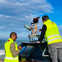
I am a surveying engineer (MSc in Geodesy) with hands-on experience on industrial, infrastructure and urban projects in Morocco and West Africa. I capture data myself (terrestrial...
Civil 3D Designer and Drafter | EIT | 11 Years Geotechnical Engineering
Midland,
TX,
United States
I'm a civil engineer (EIT) with 11 years of geotechnical engineering experience and deep daily-use expertise in AutoCAD Civil 3D. I've produced grading plans, surfaces, alignments,...
With a formal degree in Geodesy and hands-on experience as a field surveyor, I bring a highly practical approach to CAD drafting. I don't just connect dots and draw lines—I underst...
Civil, Architecture, Structural, Mechanical, Signage Design and Detailing Services
Pune,
India
We are a global CAD and BIM support team helping architecture, engineering, and construction companies deliver high-quality design and drafting work - on time and without the need...