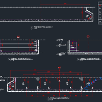
Topographic Survey Designers
Land Surveyor AutoCAD Drafting & Survey Data Processing Specialist
- Riyadh, Saudi Arabia
I am an experienced Land Surveyor with strong practical knowledge of AutoCAD, Total Station, Auto Level, site surveying, setting out, coordinate calculations, and level measurement...
Civil Engineer | Civil 3D Designer | Site, Grading, Utilities & Survey-to-CAD
- Virginia, Egypt
I'm a civil engineer and Civil 3D designer with 5 years of experience in land development, stormwater, wet utilities, and road infrastructure, with projects delivered across the Un...
Civil 3D and CAD Specialist | Topographic Mapping, Digital Terrain Modeling & Survey Data Processing
- Portfolio: 8
- Helsinki, Finland
I am a Civil 3D and CAD specialist with over 22 years of experience in topographic mapping, digital terrain modeling, and civil infrastructure documentation. My career spans full-c...
Surveyor & AutoCAD Draftsman | Civil 3D | GIS | Building & Topographic Site Plans (DWG)
- Portfolio: 1
- Western, Sri Lanka
I am a qualified Surveyor with a degree in Surveying and Geographical Information Systems and over 8 years of professional experience in AutoCAD design, Civil 3D, and GIS mapping....
Surveyor and student of geomatics engineering and topographic, specialist in earthwork optimization
- Pereira, Colombia
Senior Civil3D Map3D Revit Civil Survey Arch Designer Drafter
- Eureka, CA, United States
Qualifications Review: 25 years practical Civil, Survey, GIS experience
Civil 3D/AutoCAD, 3D Map, ArcGIS, Revit, MS Office proficient
Civil 3D and AutoCAD specialist
- Peshawar, Pakistan
I am a skilled AutoCAD and Autodesk Civil 3D professional specializing in road design, drafting, surveying, surface modeling, alignments, profiles, corridors, grading, and construc...
JGrubb_SurveyCivilCAD profile is set to private
You can still send project invites or hire the member directly.
CAD Drafter & BIM Modeler (AutoCAD, Revit, Civil 3D) | GIS Technician - 25+ years
- Santa Marta, Colombia
CAD drafter, BIM modeler and GIS technician based in Colombia, with more than 25 years of experience on civil engineering, infrastructure and industrial projects.
What I can do fo...
Water Resources & Civil Engineer | HEC-RAS | Civil 3D | Drainage Design
- Portfolio: 7
- Tehran, Iran
I am a civil engineer with over 11 years of hands-on experience in river engineering, flood modeling, and topographic & geotechnical drafting.
I specialize in using industry-stand...

Software related to Topographic Survey
- Agisoft Metashape
- ArcGIS Pro
- AutoCAD
- AutoCAD Civil 3D
- Autodesk Civil 3D
- Autodesk Infraworks
- Autodesk Navisworks
- Autodesk Revit
- CloudCompare
- DJI Terra
- HydroCAD Stormwater Modeling
- Infraworks
- Leica Cyclone 3DR
- Leica Cyclone Register 360
- MS Office
- Pix4D
- QGIS
- Trimble Business Center
- Trimble RealWorks
- covadis
Skills related to Topographic Survey
- 2D Drafting
- 3D Models
- As-Built Drawings
- BIM Modeling
- CAD Conversion
- CAD Design
- Civil Drafting
- Civil Engineering
- Construction Documentation
- Construction Drawings
- GIS Mapping
- MEP Drafting
- PDF to CAD Conversion
- Quantity Takeoff
- Revit Modeling
- Road Design
- Scan to CAD
- Site Plans
- Volume Calculation
- civil 3d corridor modeling