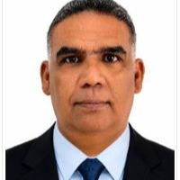
Richard R.
CAD Drafter & BIM Modeler (AutoCAD, Revit, Civil 3D) | GIS Technician - 25+ years
 Santa Marta,
Colombia
Santa Marta,
Colombia
Global rank:
33,980
/
148,190
Skill pts: 5
About
CAD drafter, BIM modeler and GIS technician based in Colombia, with more than 25 years of experience on civil engineering, infrastructure and industrial projects.
What I can do for you:
- 2D/3D technical drawings in AutoCAD: architectural, structural, plumbing and drainage, fire protection and road plans.
- Revit BIM modeling: architectural, structural and MEP models, with quantity take-offs.
- Shop drawings and as-built drawings.
- PDF, scanned or hand sketch to CAD conversion, with clean layers, dimensions and title blocks.
- Civil 3D: surfaces, contours, digital terrain models, road profiles and cross sections.
- GIS mapping in ArcGIS Pro and QGIS: thematic maps, georeferencing, water and sewer network databases.
- 3D models and renders for project presentations.
Experience highlights:
- CAD/GIS Designer at the Infrastructure Department of the City of Santa Marta, Colombia (2024-2026).
- Surveying, GIS and CAD Lead for the public utilities company of Santa Marta (water and sewer network cadastre).
- Road design and layout for the Ruta del Sol II highway project.
- 3D modeling and lifting plans for the Puerto Nuevo port project (PETREX - SAIPEM).
I am currently studying Civil Engineering at Universidad del Magdalena. I follow your standards and templates, check every drawing before delivery and keep clear communication throughout the project. Languages: Spanish (native), English (intermediate).
... more »
« less
What I can do for you:
- 2D/3D technical drawings in AutoCAD: architectural, structural, plumbing and drainage, fire protection and road plans.
- Revit BIM modeling: architectural, structural and MEP models, with quantity take-offs.
- Shop drawings and as-built drawings.
- PDF, scanned or hand sketch to CAD conversion, with clean layers, dimensions and title blocks.
- Civil 3D: surfaces, contours, digital terrain models, road profiles and cross sections.
- GIS mapping in ArcGIS Pro and QGIS: thematic maps, georeferencing, water and sewer network databases.
- 3D models and renders for project presentations.
Experience highlights:
- CAD/GIS Designer at the Infrastructure Department of the City of Santa Marta, Colombia (2024-2026).
- Surveying, GIS and CAD Lead for the public utilities company of Santa Marta (water and sewer network cadastre).
- Road design and layout for the Ruta del Sol II highway project.
- 3D modeling and lifting plans for the Puerto Nuevo port project (PETREX - SAIPEM).
I am currently studying Civil Engineering at Universidad del Magdalena. I follow your standards and templates, check every drawing before delivery and keep clear communication throughout the project. Languages: Spanish (native), English (intermediate).
Experience
- CAD / GIS Designer - Infrastructure Department City of Santa Marta (Alcaldía Distrital de Santa Marta), Colombia · Contract Feb 2024 – Jun 2026 2 yrs 4 mos Santa Marta, Magdalena, Colombia Supervision of infrastructure works and digital terrain models for city projects. Georeferencing of infrastructure, 3D models and renders. 3D modeling of water, sanitation and storm drainage networks, and location of plumbing networks for the urban improvement program Transformando mi Barrio.
- GIS Designer, CAD Technician & Site Supervisor Soluciones Hidraulicas y Construcciones S.A.S. · Full-time Jan 2021 – Dec 2022 1 yrs 11 mos Santa Marta, Magdalena, Colombia Supervision of installations and construction processes; automation of digital design workflows. Quantity take-offs for plumbing, sanitary and fire protection designs using BIM software (Revit). Architectural and structural BIM modeling and georeferencing of project sites.
- Surveying, GIS & CAD Lead (water and sewer network cadastre) Empresa de Servicios Publicos de Santa Marta (ESSMAR) · Contract Apr 2019 – Aug 2020 1 yrs 4 mos Santa Marta, Magdalena, Colombia Management and updating of the water and sewer network cadastre in the city's geographic information system (ArcGIS). Coordination of topographic surveys and georeferencing with sub-meter GPS. Thematic maps for analysis and strategic decision-making.
Education
- Universidad del Magdalena Bachelor's degree in Civil Engineering (in progress, 4th semester), Civil Engineering 2026 – 2029 (expected) Currently studying. Admitted through professional competency validation, with 52 credits recognized for prior experience (approximately 4th semester). Expected graduation: 2029.
Stats
0 followers, 0 following
Joined: September 26, 2026
Last seen: September 26, 2026
Area of Expertise
Languages
English Limited working proficiency
Spanish Native or bilingual proficiency
Location
Santa Marta, Colombia