Civil Engineer specialized in AutoCAD drafting and Revit MEP modeling. Experience working remotely with an international team on residential projects, using Revit Cloud and Naviswo...
Hello, and welcome to my profile! With a solid 7-year track record in the field of AutoCAD drafting, 3D modeling, and GIS technology, I am a dedicated professional who takes pride...
🏗️ Precision Meets Creativity: Civil Engineering, Surveying, CAD Drafting & Copywriting Expert
Hi! I am a multi-skilled professional with over 10+ years of experience in Civil Eng...
2D & 3D Architectural Design2D & 3D Modeling Solidworks2D House Design2D/3D AutoCAD20
more
Civil engineer and architect dedicated to bridging structural precision with sustainable design
Surabaya,
Indonesia
I am a Civil Engineering graduate from the University of Jember in 2025. I am a person who always wants to learn and develop with good communication, leadership, responsibility, an...
I am a Landscape Architect, Urban Designer, and Urban Planner with expertise as a BIM Modeler and Architect. I specialize in sustainable design, placemaking, and projects involving...
I am an experienced civil engineer in contracting with mega size companies in the gulf region. I am experienced in project management and able to do contracting works from A to Z i...
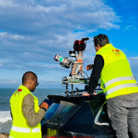
I am a surveying engineer (MSc in Geodesy) with hands-on experience on industrial, infrastructure and urban projects in Morocco and West Africa. I capture data myself (terrestrial...