CAD Design Professional with expertise in various software programs such as AutoCAD, and Google map
Tanzania
I am a CAD Draftsman with 10 years of experience. I already working as a cad draftsman on another freelancer site. My skills in CAD software and google file and my specialization i...
AutoCAD 2D DraftingCAD DesignGoogle Earth to CADMicrosoft Office
CAREER SUMMARY
❖ Substantial knowledge in the delivery of high quality drafting design
documentation in architectural field being a Cad Technician.
❖ Trained in International consu...
I have 12 years of professional experience in GIS mapping, survey drafting, and geospatial data processing. I help clients turn raw survey and spatial data into accurate, easy-to-u...
AutoCAD Drafter | Telecom OSP | Utility & Conduit Routing | Redline to Construction Drawings
Carmichael,
CA,
United States
I am an AutoCAD Drafter with 5+ years of experience supporting utility and telecommunications projects.
My work focuses on converting redlines, field notes, and engineering markup...
Hlo,
I have more than 8 years of experience as a architecture & structural, Sites plan, Survey Plan Drafting. Also i am a "GIS" expert.I always try to deliver work on time.
Profici...
A little about myself I have worked in engineering as a CAD Designer for a little over a decade. My experience includes working in municipalities, utilities, renewables and oil and...
Transform Paper to CAD and More
No need to scroll anymore. I'm M Naveed Saeed, a Computer Science Graduate and Co-Founder of HS Bro. Solutions®. With over 22+ years in GIS/IS map...
A young, enthusiastic, and proactive professional open for all types of architectural drafting work. I am specialize in 2D AutoCAD, documentation of construction drawings and Quant...
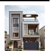
Designer-Residential Architectural, Plans to 3D models
Littleton,
CO,
United States
From basic floor plans to complex 3D building models, I have the skills and talent to produce what you need.
Over 16 years of CAD experience in the Residential Buildin...