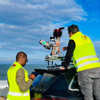
I am a surveying engineer (MSc in Geodesy) with hands-on experience on industrial, infrastructure and urban projects in Morocco and West Africa. I capture data myself (terrestrial...
Civil 3D Designer and Drafter | EIT | 11 Years Geotechnical Engineering
Midland,
TX,
United States
I'm a civil engineer (EIT) with 11 years of geotechnical engineering experience and deep daily-use expertise in AutoCAD Civil 3D. I've produced grading plans, surfaces, alignments,...
Experience as a Structural Engineering Draftsman, Engineering Surveyor, Architectural Design and Drafting and 3D Design and Drafting for 14 years. I can work on AutoCAD, Revit, Ske...
I've studied architecture. In Ireland I am registered as Graduate Architecture at RIAI. In Mexico I hold a recognised architect's licence. I have an MSc in Management. Competent in...
2D & 3D Architectural Design2D & 3D Renderings2D & 3D by autodesk inventorAutoCAD8
more