LiDAR Mapping Designers
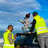
Surveying Engineer | Scan to BIM, Point Cloud to Revit & AutoCAD | Civil 3D | Drone Mapping
- Portfolio: 2
- Rabat, Morocco
I am a surveying engineer (MSc in Geodesy) with hands-on experience on industrial, infrastructure and urban projects in Morocco and West Africa. I capture data myself (terrestrial...
Software related to LiDAR Mapping
Skills related to LiDAR Mapping
- 3D Modeling
- Actuator Selection
- C++ Programming
- CAD Design
- Civil Engineering
- Drafting
- Embedded Control Systems
- FPGA Design
- Floor Plans
- GIS
- GIS / CAD Specialist
- Geospatial Services
- Land Survey Drawing
- Land Surveying
- Landscape 3D Modeling
- LiDAR Surveying
- MATLAB Programming
- Photogrammetry
- Python Programming
- Rendering