Digital Terrain Model Designers

Civil 3D and CAD Specialist | Topographic Mapping, Digital Terrain Modeling & Survey Data Processing
- Portfolio: 8
- Helsinki, Finland
I am a Civil 3D and CAD specialist with over 22 years of experience in topographic mapping, digital terrain modeling, and civil infrastructure documentation. My career spans full-c...
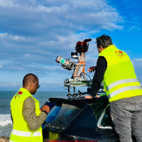
Surveying Engineer | Scan to BIM, Point Cloud to Revit & AutoCAD | Civil 3D | Drone Mapping
- Portfolio: 2
- Rabat, Morocco
I am a surveying engineer (MSc in Geodesy) with hands-on experience on industrial, infrastructure and urban projects in Morocco and West Africa. I capture data myself (terrestrial...
Software related to Digital Terrain Model
- Agisoft Metashape
- ArcGIS Pro
- AutoCAD
- AutoCAD Civil 3D
- AutoCAD Raster Design
- Autodesk Civil 3D
- Autodesk Navisworks
- Autodesk Recap
- Autodesk Revit
- BIM Credo Topoplan
- CloudCompare
- DJI Terra
- Global Mapper
- Leica Cyclone 3DR
- Leica Cyclone Register 360
- Lumion
- Pix4D
- Trimble Business Center
- Trimble RealWorks
- covadis
Skills related to Digital Terrain Model
- 3D Architectural Modeling
- As-Built Drawings
- AutoCAD 2D Drafting
- CAD Design
- CAD Drafting
- Civil Drafting
- Civil Engineering Drawings
- Contour Lines
- Contour Mapping
- Earthwork Calculations
- Land Surveying
- Pipeline Mapping
- Plan and profiles
- Point Cloud Extraction
- Point Cloud to Cad
- Pointcloud
- Revit Modeling
- Topography
- Topography and Cartography
- Utility Drafting