
Bakr S.
Civil 3D & GIS Specialist | Roads and Earthwork
 Giza,
Egypt
Global rank:
36,197
/
155,374
Skill pts: 5
About
I provide Civil 3D, AutoCAD and GIS technical-office support for survey, road and earthwork assignments.
With surveying experience since 2004, I combine practical field understanding with structured CAD/GIS production and traceable handover. I lead survey and technical operations through GeoGiza and work with contractors, engineering teams and landowners.
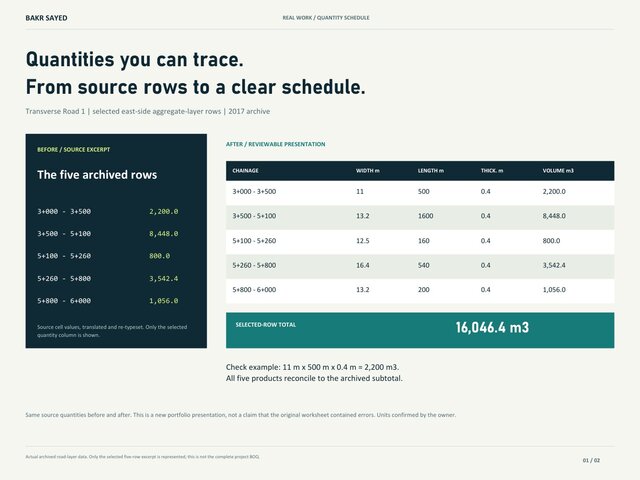
My focus is road drawing/model support from supplied terrain and agreed criteria; cut/fill and road-layer quantities; checked survey-point files; AutoCAD revisions from approved markups; and QGIS/ArcGIS data organization and mapping.
A typical scope defines source versions, coordinate reference and units, drawing/model requirements, quantities to measure and delivery dates. Handover can include agreed-version DWG/Civil 3D files, PDF sheets, Excel schedules and a short QA/RFI register. I flag unresolved source issues rather than silently inventing values.
The portfolio distinguishes archived project evidence from new presentation exercises and reconstructed terrain exhibits. Each case states my actual role. My relevant formal qualification is a technical diploma in general surveying; professional signing, sealing and authority approval are outside my services.
Tools: AutoCAD Civil 3D, AutoCAD, QGIS, ArcGIS, Trimble Business Center and Excel. Arabic: native. English: conversational. Availability and communication-hour overlap are agreed per assignment. Please share your inputs and desired outputs through Cad Crowd to define a practical first deliverable.
... more »
« less
With surveying experience since 2004, I combine practical field understanding with structured CAD/GIS production and traceable handover. I lead survey and technical operations through GeoGiza and work with contractors, engineering teams and landowners.
My focus is road drawing/model support from supplied terrain and agreed criteria; cut/fill and road-layer quantities; checked survey-point files; AutoCAD revisions from approved markups; and QGIS/ArcGIS data organization and mapping.
A typical scope defines source versions, coordinate reference and units, drawing/model requirements, quantities to measure and delivery dates. Handover can include agreed-version DWG/Civil 3D files, PDF sheets, Excel schedules and a short QA/RFI register. I flag unresolved source issues rather than silently inventing values.
The portfolio distinguishes archived project evidence from new presentation exercises and reconstructed terrain exhibits. Each case states my actual role. My relevant formal qualification is a technical diploma in general surveying; professional signing, sealing and authority approval are outside my services.
Tools: AutoCAD Civil 3D, AutoCAD, QGIS, ArcGIS, Trimble Business Center and Excel. Arabic: native. English: conversational. Availability and communication-hour overlap are agreed per assignment. Please share your inputs and desired outputs through Cad Crowd to define a practical first deliverable.
Experience
- Partner, General Manager & Survey Technical Lead Giza for Trading & Contracting / GeoGiza · Self-employed Sep 2019 – Present 7 yrs 2 mos Giza, Egypt Lead survey operations and technical-office workflows across roads, utilities, rail control, land development, and construction assignments. Responsibilities include survey-control methodology, GNSS/RTK/static workflows, topographic and as-built delivery, Civil 3D/CAD production, road and earthwork quantities, QA/QC, team coordination, and client handover.
Stats
0 followers, 0 following
Joined: November 6, 2026
Last seen: November 6, 2026
Area of Expertise
Languages
Arabic Native or bilingual proficiency
English Limited working proficiency
Location
Giza, Egypt