I am an Architect and Master of Landscape Architecture with five years of extensive experience across residential, commercial, and institutional projects. I excel in leading multid...
Birone Agutu - Building and Civil Technologist
With a robust background in building and civil technology, I specialize in creating precise and innovative designs using AutoCAD,Arc...
Linear Edifice is a registered architectural and construction firm with 12+ years of experience in providing comprehensive services for building design, planning, and construction....
I've studied architecture. In Ireland I am registered as Graduate Architecture at RIAI. In Mexico I hold a recognised architect's licence. I have an MSc in Management. Competent in...
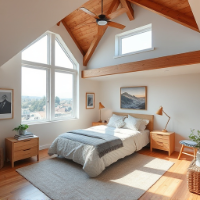
2D & 3D Architectural Design2D & 3D Renderings2D & 3D by autodesk inventorAutoCAD4
more
Architectural Technologist and Interior Design professional with over 20 years of experience across commercial, healthcare, hospitality, industrial and residential projects. Strong...
Cuban born and educated, South African trained. More than 10years of experience working as an architect in SA, SACAPregistered as PrArch since 2012. Has worked on private and gover...
Civil engineer and architect dedicated to blending structural precision with sustainable design
Surabaya,
Indonesia
I am a Civil Engineering graduate from the University of Jember in 2025. I am a person who always wants to learn and develop with good communication, leadership, responsibility, an...
Priya has been engaged in many facets of Architectural and engineering projects (Preconstruction/3D/BIM) for some Eleven years. Since 2008 she has been successfully managing all th...
Camilo has 20 years of experience in Architectural design developing projects and managing teams, for achieving desired project outcomes, on large infrastructure projects from conc...
Japhlet.
▒▒▒▒▒▒▒▒▒▒▒▒▒▒▒▒▒▒▒▒
I am a self motivated graduate Architectural Draftsman-technologist,with over 10 years of experience proactively preparing quality professional 2D&3D...