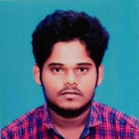
Muhil N.
Remote Sensing & GIS | Satellite Data Processing | Certified RPC Pilot | ML Workflows
 Chennai,
India
Chennai,
India
Global rank:
33,113
/
151,245
Skill pts: 5
About
GIS and Remote Sensing professional pursuing an M.Tech in Remote Sensing & GIS at Bharathidasan University, with hands-on experience in drone image processing, satellite imagery analysis, machine learning-based classification, and hazard/site-suitability mapping. Proficient in QGIS, ArcGIS Pro, ENVI, Agisoft Metashape, Google Earth Engine, and Python-based geospatial workflows. DGCA-certified Remote Pilot (RPC) with practical UAV mapping experience across multiple industry internships.
... more »
« less
Experience
-
GeoAI Blue Carbon Mapping and Monitoring of Wetland Mangroves
M S Swaminathan Research Foundation · Internship
May 2026 –
Jul 2026
2 mos
Chennai, Tamil Nadu, India
• Worked on "GeoAI Blue Carbon Mapping and Monitoring of Wetland Mangroves," involving drone image processing and mangrove species classification using machine learning techniques on multispectral drone imagery.
• Independently carried out paddy yield estimation using NDVI derived from PlanetScope satellite imagery. -
QC and mapping of LULC features from UAV drone imagery
Velciti Consulting Engineers Pvt. Ltd. · Internship
May 2025 –
Nov 2025
6 mos
Chennai, Tamil Nadu, India
• Contributed to the NAKSHA Project (L&T Mindtree) - QC and mapping of topographic and LULC features extracted from UAV drone imagery.
• Mapped and extracted topographic features, land records, land parcels, drainage networks, utilities, and land use/land cover features.
Education
- Bharathidasan University (BDU), Tiruchirappalli M.Tech, Remote Sensing & GIS 2025 – 2027 (expected)
- Bharathidasan University (BDU), Tiruchirappalli B.Tech, Geological Technology & Geoinformatics, 81.5% (First Class) 2021 – 2025
Stats
0 followers, 0 following
Joined: August 30, 2026
Last seen: August 30, 2026
Languages
English Professional working proficiency
Location
Chennai, India