

QGIS Land Data | Layer Organization and QA

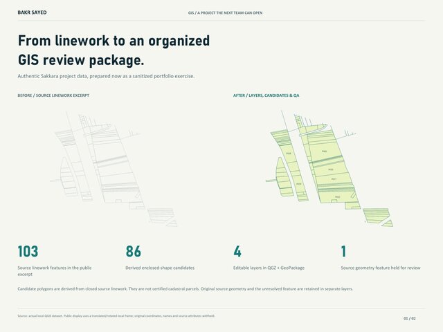
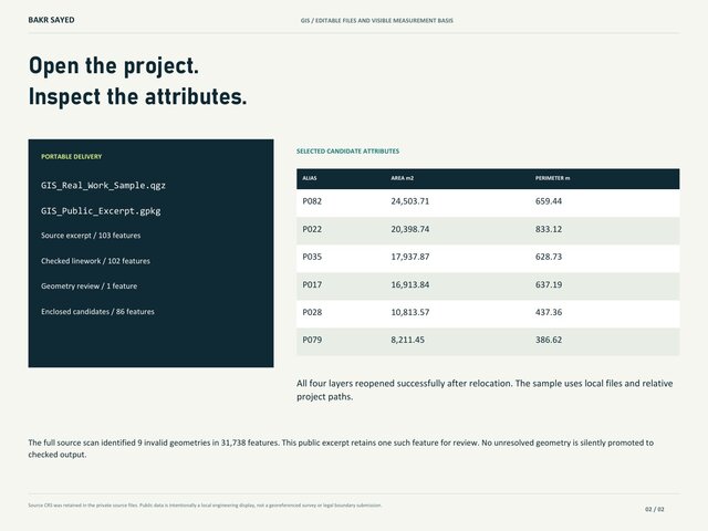
I prepared a new GIS presentation exercise using authentic archived Saqqara project data. It organizes 103 source line features into four editable layers, with 86 derived closed candidates for review and a separate layer for one geometry issue. The presentation shows area/perimeter schedules and portable-project packaging.
My role in this exercise: data organization, GIS processing, review layers and delivery preparation. The derived shapes are not certified ownership parcels. The display frame is local and source coordinates are withheld. The unresolved geometry remains identified for source review.
Published