I will create Maps and Geospatial analyze use Arcmap


About this service
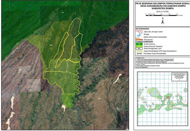
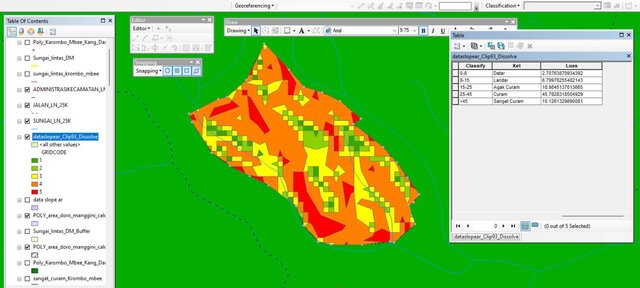
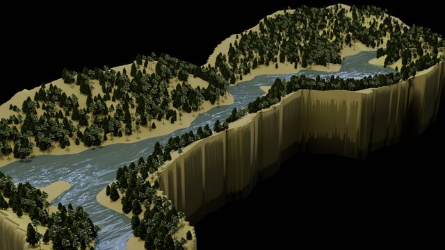
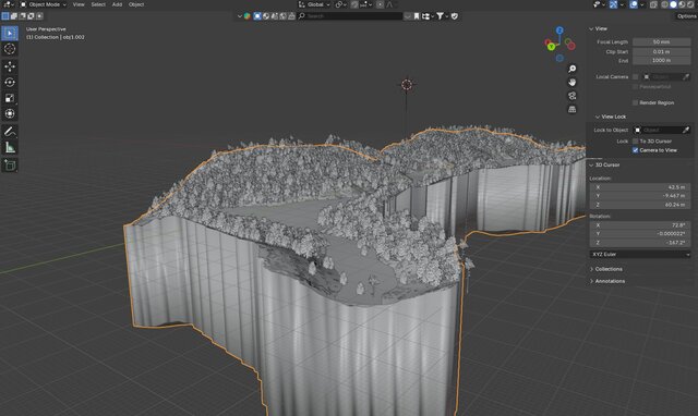
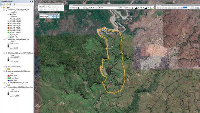
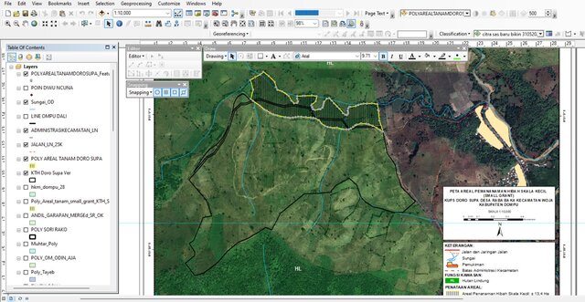
I make a map based on imagery, Satellite/Google Maps, and field data from surveys and observations, creating the polygon and calculating geometry from the layout itself. Sometimes i try to figure out the classification of the area to know about the slope, elevation and more. Also, I make 3D presentations from the real topography data and create some 3D designs at the request of the Client.
The software that i use is Arc Map, SAS Planet, Google Earth, and Blender.
The software that i use is Arc Map, SAS Planet, Google Earth, and Blender.
I make a map based on imagery, Satellite/Google Maps, and field data from surveys and observations, creating the polygon and calculating geometry from the layout itself. Sometimes i try to figure out the classification of the area to know about the slope, elevation and more. Also, I make 3D presentations from the real topography data and create some 3D designs at the request of the Client.
The so... read more
The so... read more
I make a map based on imagery, Satellite/Google Maps, and field data from surveys and observations, creating the polygon and calculating geometry from the layout itself. Sometimes i try to figure out the classification of the area to know about the slope, elevation and more. Also, I make 3D presentations from the real topography data and create some 3D designs at the request of the Client.
The software that i use is Arc Map, SAS Planet, Google Earth, and Blender. read less
The software that i use is Arc Map, SAS Planet, Google Earth, and Blender. read less
Service offer categories
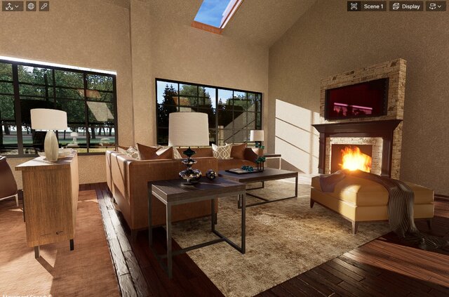
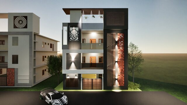
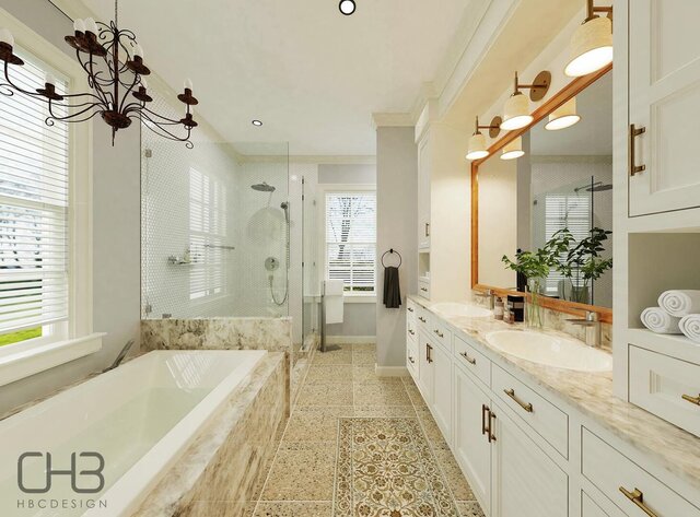
3D Visualization Services
Software & skills
ArcGIS
ArcGIS Pro
ArcMap
ESRI ArcMap
Geographic Information Systems
Google Earth
Surveying
+4 more
Portfolio

Member since
October 2025
Languages
English,
Indonesian
Avg. response time
1 hour
3D Modeler assets
Hello let me introduce my self,
I'm Revinaldin, you can call me Revin
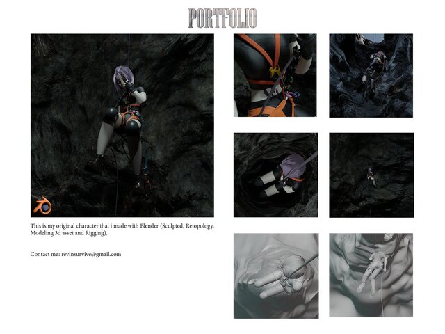
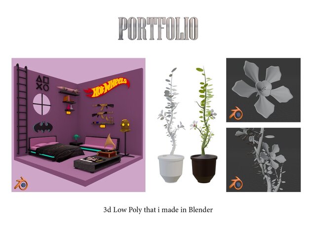
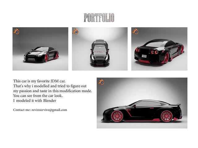
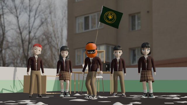
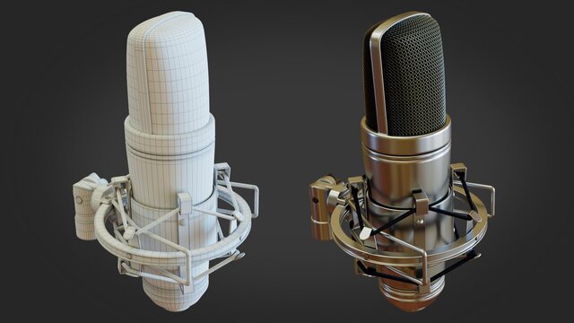
I'm 3d artist specialize for 3d modeling, rigging, animation, lighting and sculpting use Blender 3d software
I also edit some footage use adobe premiere and apply some effect or color grading on it
Also Convert 2D logo to 3D in Blender
Another skill that i have beside 3D visual and Design Graphic is work as a Cartographer, i us... read more
I'm Revinaldin, you can call me Revin
I'm 3d artist specialize for 3d modeling, rigging, animation, lighting and sculpting use Blender 3d software
I also edit some footage use adobe premiere and apply some effect or color grading on it
Also Convert 2D logo to 3D in Blender
Another skill that i have beside 3D visual and Design Graphic is work as a Cartographer, i us... read more

Cad Crowd Billing Security policy
Service quality is protected by Cad Crowd Billing Security policy.
More from Revinaldin R.
More similar services
From
$100
See related services
- 3D Design services
- 3D Modeling services
- CAD Design services
- 2D & 3D Design services
- 2D & 3D Modeling services
- Drafting services
- AutoCAD services
- 3D Models services
- Mechanical Design services
- Product Design services
- Rendering services
- 2D AutoCAD services
- 3D Product Design services
- 3D Rendering services
- SolidWorks services
- Architectural Design services
- Rendering 3D Design services
- 2D & 3D Drafting services
- 2D/3D AutoCAD services
- 2D & 3D Modeling Solidworks services
- 2D & 3D Architectural Design services
- Floor Plans services
- 3D Visualization services
- Industrial Design services
- Mechanical Engineer services
- 3D Architectural Rendering services
- Interior Design services
- Product Development services
- Prototyping services
- Photorealistic Rendering services
- Architectural Visualization services
- 3D Architectural Visualization services
- 3D Interior Rendering Design services
- SketchUp services
- 2D & 3D Renderings services
- 3D Animation services