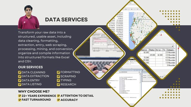
I will transform your geo data via cleaning, conversion, digitization, and geocoding


About this service
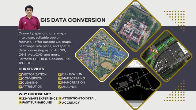
Tired of unreliable map data? Experienced Computer Science Graduate GIS specialist with over 22+ years of expertise. Convert paper or digital maps into clean, editable vector formats. I offer custom GIS maps, heatmaps, site plans, and spatial data processing using ArcGIS, QGIS, AutoCAD, and more. Formats: SHP, KML, GeoJson, PDF, JPG, TIFF.
My Services:
Accurate Vectorization & Digitization: Transform your existing maps (paper or digital) into clean, editable vector formats for seamless GIS integration.
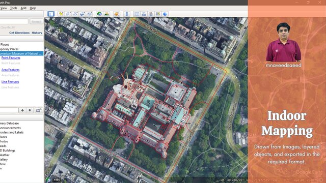
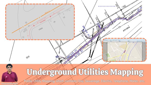
Custom GIS Map Creation: Need a map for a specific location? Craft high-quality digital maps for indoor or outdoor venues, utilities, surveys, Heatmaps, Data/location plotting, Site plans, Reports, and more.
Data Conversion, Cleaning & Processing: Convert raster maps to vectors, and efficiently manage and organize your spatial data.
Tools: ArcGIS, QGIS, AutoCAD, Microstation, Google Earth, Global Mapper, etc.
Formats: Shapefile (SHP), GeoJson, KML/KMZ, DGN, PDF, JPG, Tiff...
Why Choose Me?
Proven Track Record: Successfully digitized 5,000 km of road assets and 4,000+ indoor/outdoor maps (see portfolio).
Quality & Efficiency: Deliver high-accuracy maps at competitive prices
My Services:
Accurate Vectorization & Digitization: Transform your existing maps (paper or digital) into clean, editable vector formats for seamless GIS integration.
Custom GIS Map Creation: Need a map for a specific location? Craft high-quality digital maps for indoor or outdoor venues, utilities, surveys, Heatmaps, Data/location plotting, Site plans, Reports, and more.
Data Conversion, Cleaning & Processing: Convert raster maps to vectors, and efficiently manage and organize your spatial data.
Tools: ArcGIS, QGIS, AutoCAD, Microstation, Google Earth, Global Mapper, etc.
Formats: Shapefile (SHP), GeoJson, KML/KMZ, DGN, PDF, JPG, Tiff...
Why Choose Me?
Proven Track Record: Successfully digitized 5,000 km of road assets and 4,000+ indoor/outdoor maps (see portfolio).
Quality & Efficiency: Deliver high-accuracy maps at competitive prices
Tired of unreliable map data? Experienced Computer Science Graduate GIS specialist with over 22+ years of expertise. Convert paper or digital maps into clean, editable vector formats. I offer custom GIS maps, heatmaps, site plans, and spatial data processing using ArcGIS, QGIS, AutoCAD, and more. Formats: SHP, KML, GeoJson, PDF, JPG, TIFF.
My Services:
Accurate Vectorization & Digitization: Transform your existing maps (paper or digital) into clean, editable vector formats for seamless GIS integration.
Custom GIS Map Creation: Need a map for a specific location? Craft high-quality digital maps for indoor or outdoor venues, utilities, surveys, Heatmaps, Data/location plotting, Site plans, Reports, and more.
Data Conversion, Cleaning & Processing: Convert raster maps to vectors, and efficiently manage and organize your spatial data.
Tools: ArcGIS, QGIS, AutoCAD, Microstation, Google Earth, Global Mapper, etc.
Formats: Shapefile (SHP), GeoJson, KML/KMZ, DGN, PDF, JPG, Tiff...
Why Choose Me?
Proven Track Record: Successfully digitized 5,000 km of road assets and 4,000+ indoor/outdoor maps (see portfolio).
Quality & Efficiency: Deliver high-accuracy maps at competitive prices
Tired of unreliable map data? Experienced Computer Science Graduate GIS specialist with over 22+ years of expertise. Convert paper or digital maps into clean, editable vector formats. I offer custom GIS maps, heatmaps, site plans, and spatial data processing using ArcGIS, QGIS, AutoCAD, and more. Formats: SHP, KML, GeoJson, PDF, JPG, TIFF.
My Services:
Accurate Vectorization & Digitization: Trans... read more
My Services:
Accurate Vectorization & Digitization: Trans... read more
Tired of unreliable map data? Experienced Computer Science Graduate GIS specialist with over 22+ years of expertise. Convert paper or digital maps into clean, editable vector formats. I offer custom GIS maps, heatmaps, site plans, and spatial data processing using ArcGIS, QGIS, AutoCAD, and more. Formats: SHP, KML, GeoJson, PDF, JPG, TIFF.
My Services:
Accurate Vectorization & Digitization: Transform your existing maps (paper or digital) into clean, editable vector formats for seamless GIS integration.
Custom GIS Map Creation: Need a map for a specific location? Craft high-quality digital maps for indoor or outdoor venues, utilities, surveys, Heatmaps, Data/location plotting, Site plans, Reports, and more.
Data Conversion, Cleaning & Processing: Convert raster maps to vectors, and efficiently manage and organize your spatial data.
Tools: ArcGIS, QGIS, AutoCAD, Microstation, Google Earth, Global Mapper, etc.
Formats: Shapefile (SHP), GeoJson, KML/KMZ, DGN, PDF, JPG, Tiff...
Why Choose Me?
Proven Track Record: Successfully digitized 5,000 km of road assets and 4,000+ indoor/outdoor maps (see portfolio).
Quality & Efficiency: Deliver high-accuracy maps at competitive prices read less
Service offer categories
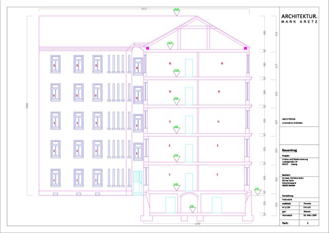
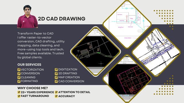
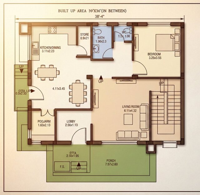
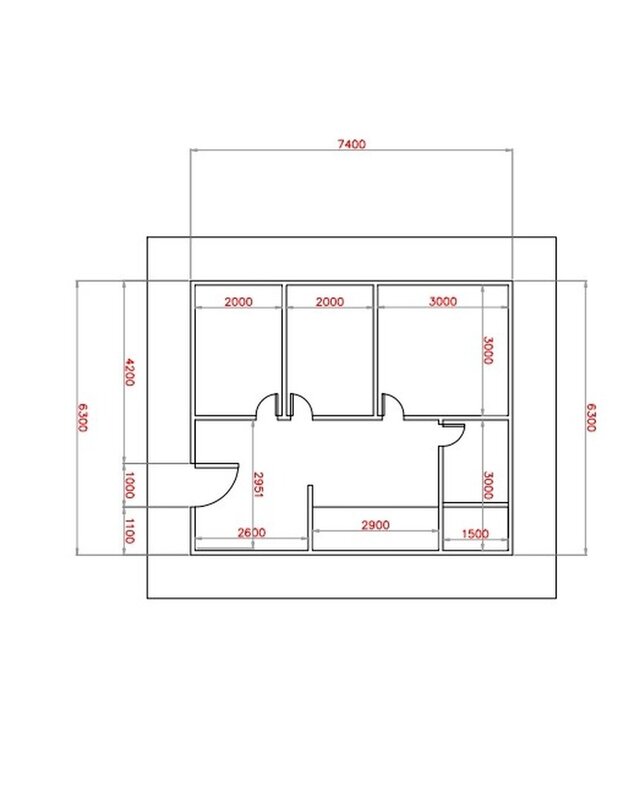
2D Drawings and Floor Plans
Software & skills
ArcGIS
ArcGIS Pro
AutoCAD
CAD File Type Conversion
GIS
GIS / CAD Specialist
GIS Mapping
Google Earth
PDF to CAD Conversion
QGIS
+7 more
This service includes
| Service tiers | Simple $100 | Standard $150 | Advanced $200 |
|---|---|---|---|
| Summary | Basic Geolocalized Map | Medium Geolocalized Map | Large Geolocalized Map |
| Details | We offer Vectorization of survey maps, urban development, zoning plans, etc. Area<=0.1 Sq. KM | We offer Vectorization of survey maps, urban development, zoning plans, etc. Area<=0.2 Sq. KM | We offer Vectorization of survey maps, urban development, zoning plans, etc. Area<=0.3 Sq. KM |
| Delivery time | 1 day | 2 days | 3 days |
| Number of revisions | 1 | 1 | 1 |
Member since
October 2025
Languages
English,
Urdu,
French
Avg. response time
1 hour
22 Years: GIS Mapping, Cadastral Mapping, 2D Architectural Plans
Transform Paper to CAD and More
No need to scroll anymore. I'm M Naveed Saeed, a Computer Science Graduate and Co-Founder of HS Bro. Solutions®. With over 22+ years in GIS/IS map data services, we guarantee world-class results.
Services I Offer:
Map Data Conversion & GIS Maps
Raster to Vector Conversion, including CAD, Image, 2D Floor Plans, etc.
Data Cleaning & Reformation
Utility & Cadastral M... read more
Questions and answers
I can use any available format that could be an image file (but should be with better resolution), CAD file, or any raster/vector format which is a valid file.
I work in Shapefile format which is supportive of GIS software like ArcGIS or QGIS. The output could be any raster format i.e. PDF, JPG, TIFF, etc., or any Vector format like SHP, GeoJson, Google Earth KML/KMZ, Microstation DGN, etc.
I use the most common GIS tools likes of ArcGIS, QGIS, AutoCAD, Global Mapper, Microstation, and Google Earth.

Cad Crowd Billing Security policy
Service quality is protected by Cad Crowd Billing Security policy.
More from Muhammad Naveed S.
More similar services
See related services
- 3D Design services
- 3D Modeling services
- CAD Design services
- 2D & 3D Design services
- 2D & 3D Modeling services
- Drafting services
- AutoCAD services
- 3D Models services
- Rendering services
- 2D Drafting services
- 2D Drawing services
- 2D AutoCAD services
- CAD Drafting services
- 3D Rendering services
- Architectural Design services
- SolidWorks services
- CAD Drawing services
- 2D & 3D Drafting services
- 2D/3D AutoCAD services
- Architectural Drawings services
- 2D & 3D Architectural Design services
- Floor Plans services
- 3D Visualization services
- Architectural Drafting services
- 3D Architectural Rendering services
- Interior Design services
- Construction Drawings services
- 2D & 3D Floor Plans services
- AutoCAD 2D Architectural Drawings services
- 3D Architectural Visualization services
- SketchUp services
- 2D & 3D Renderings services
- 2D Floor Plan Drawings services
- Elevations services
- Detailing services
- Autodesk Autocad services