"I will do GIS & Topographic maps, Land survey plans, Contour and Cadastral drawings"


About this service
I will create accurate topographic maps, land survey drawings, contour maps, and cadastral plans tailored to your project needs. Using professional survey and mapping software, I deliver precise, clear, and detailed plans suitable for design, planning, and approvals.
What you get:
✔ Detailed topographic maps with elevations and land features ✔ 3D Terrain Modelling
✔ Accurate contour maps for slope, terrain, and grading analysis
✔ Land survey drawings with property boundaries and coordinates
✔ Cadastral plans for land ownership, subdivision, and legal purposes
✔ Clear representation of roads, utilities, buildings, and landmarks
✔ Output files in your preferred format (PDF, JPEG, DWG, or SHP)
I will create accurate topographic maps, land survey drawings, contour maps, and cadastral plans tailored to your project needs. Using professional survey and mapping software, I deliver precise, clear, and detailed plans suitable for design, planning, and approvals.
What you get:
✔ Detailed topographic maps with elevations and land features ✔ 3D Terrain Mode... read more
What you get:
✔ Detailed topographic maps with elevations and land features ✔ 3D Terrain Mode... read more
I will create accurate topographic maps, land survey drawings, contour maps, and cadastral plans tailored to your project needs. Using professional survey and mapping software, I deliver precise, clear, and detailed plans suitable for design, planning, and approvals.
What you get:
✔ Detailed topographic maps with elevations and land features ✔ 3D Terrain Modelling
✔ Accurate contour maps for slope, terrain, and grading analysis
✔ Land survey drawings with property boundaries and coordinates
✔ Cadastral plans for land ownership, subdivision, and legal purposes
✔ Clear representation of roads, utilities, buildings, and landmarks
✔ Output files in your preferred format (PDF, JPEG, DWG, or SHP) read less
Service offer categories
AutoCAD Drawing Services
Civil Drafting Services
Software & skills
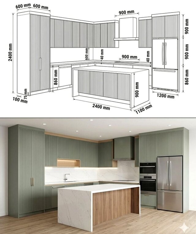
3D Sketchup Rendering
ArcGIS
AutoCAD Civil 3D
QGIS
+1 more


This service includes
| Service tiers | Simple $150 | Standard $200 | Advanced $350 |
|---|---|---|---|
| Summary | Basic map design | Standard map design | Detailed contour map, topographic map. |
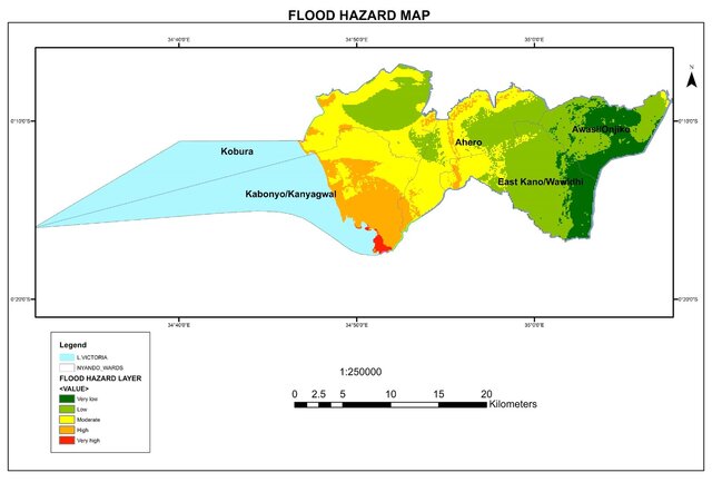
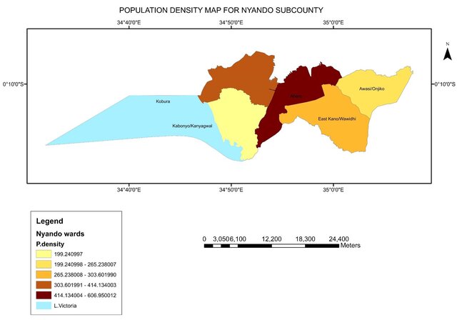
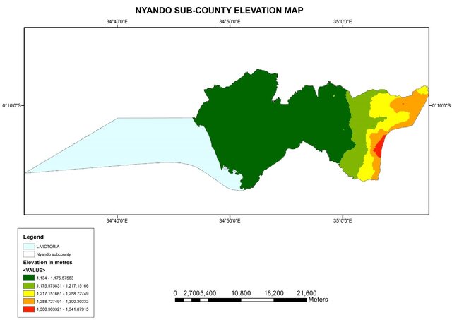
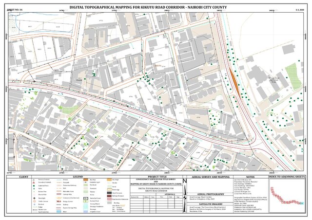
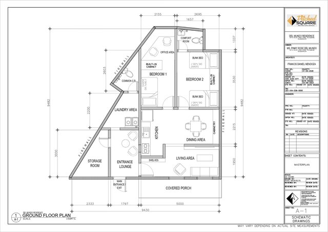
| Details | What’s included: Custom-designed 2D static map Highlight key locations, routes, or landmarks Simple color palette and icons Delivered as high-quality PNG, JPG, or PDF | What’s included: Professionally designed custom 2D map Moderate level of detail (roads, landmarks, districts, icons) Custom color palette and branding (if required) Legend, compass, labels, and other standard map elements High-resolution files (PNG, JPG, PDF) | Land survey drawings Property description drawings 2D site plan drawings. Lot plans with bearings Cadastral plans Contour plans |
| Delivery time | 5 days | 7 days | 10 days |
| Number of revisions | 2 | 3 | 5 |
Member since
October 2024
Languages
English,
French,
Dutch
Avg. response time
1 hour
Engineer-Technical Designer
Creative and highly skilled architectural designer with over 10 years of experience delivering innovative solutions on time. Specializing in GIS, site planning, master planning, and mapping. Expert in transforming concepts into functional, aesthetic spaces while integrating data-driven spatial analysis to support sustainable and strategic design decisions across diverse project scales.

Cad Crowd Billing Security policy
Service quality is protected by Cad Crowd Billing Security policy.
More from Ken M.

More similar services
See related services
- 3D Design services
- 3D Modeling services
- CAD Design services
- 2D & 3D Design services
- 2D & 3D Modeling services
- Engineering Design services
- 2D & 3D CAD Design services
- Drafting services
- AutoCAD services
- 3D Models services
- Mechanical Design services
- Product Design services
- Rendering services
- 2D Drafting services
- 2D Drawing services
- 2D AutoCAD services
- CAD Drafting services
- 3D Rendering services
- Architectural Design services
- SolidWorks services
- 3D Solidworks services
- CAD Drawing services
- Mechanical Engineering services
- 2D & 3D Drafting services
- 2D/3D AutoCAD services
- 2D & 3D Modeling Solidworks services
- Floor Plans services
- Architectural Drafting services
- Mechanical Engineer services
- Design Engineer services
- Interior Design services
- Construction Drawings services
- AutoCAD Mechanical services
- Structural Design services
- FEA services
- Product Development services