


Urban GIS Analysis - Kabul District 5

Urban GIS Analysis - Kabul District 5
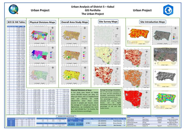
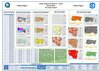
This project presents a comprehensive urban GIS analysis of District 5 in Kabul, Afghanistan. Our team conducted site visits, surveys, and data collection to generate key spatial datasets, which were then visualized in detailed thematic maps.
The project includes:
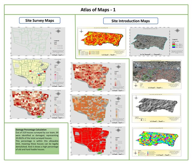
Site Introduction Maps (imagery, slope, elevation, boundaries)
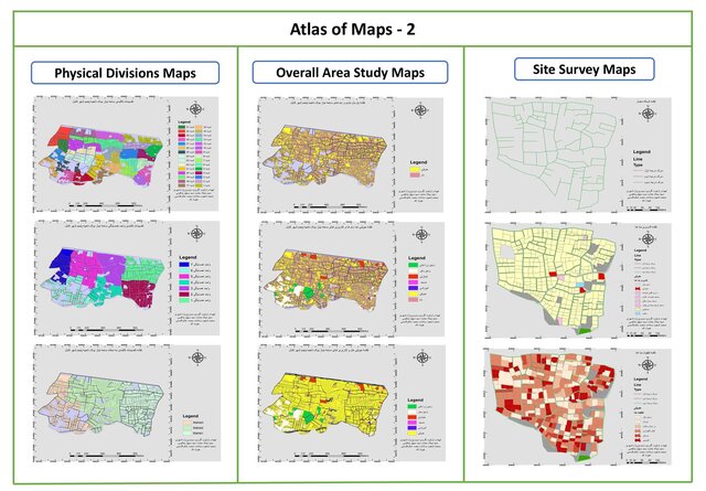
Survey-Based Maps (parcel layout, damage assessment, housing condition)
Overall Area Study Maps (land use, access, utilities)
Physical Division Maps (blocks, neighborhoods, and zones)
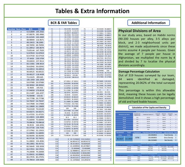
BCR & FAR Tables (built coverage ratio & floor area ratio)
Density Calculations (total, gross, and net population densities)
All maps were designed using ArcGIS and follow professional cartographic standards. Layouts were tailored for clarity and usability in urban planning.
Team Size: 7 members
My Role: GIS Analyst & Project Lead
Tools Used: ArcMap, ArcGIS Pro, Excel