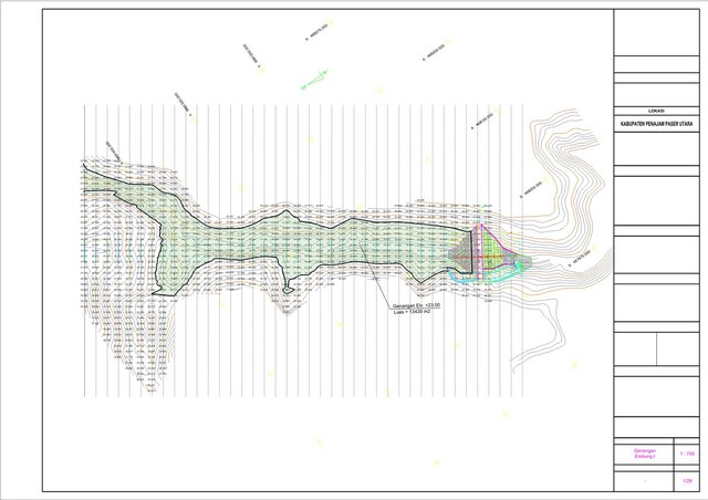

Civil Site Plan & Topographic Layout: Water Retention Basin (Detention Pond)

Developed a comprehensive topographic site plan and grading layout for a large-scale water retention basin (Embung I) located in the new capital city development region (IKN - Penajam Paser Utara). This portfolio piece demonstrates advanced proficiency in civil site planning, topographic mapping, and earthwork drafting for hydrological infrastructure.
Role:Civil CAD Drafter / Site Planning SpecialistKey Responsibilities & Technical Deliverables:Topographic Mapping & Grading: Processed field survey data to generate precise existing ground contours and proposed grading plans for the basin and embankment structures. Hydrological Capacity & Footprint: Accurately delineated the maximum water inundation footprint, defining a total surface area of 13,430 square meters at a specific design elevation (Elv. +23.00). Coordinate Geometry (COGO) & Grid Layouts: Established a strict X/Y Cartesian coordinate grid system (e.g., X: 468200.000, Y: 9891250.000) to ensure precise structural placement and field setting-out for contractors. Earthwork Stationing: Laid out systematic cross-section reference lines across the entire basin footprint to facilitate accurate cut-and-fill volume calculations and profile generation.
Published