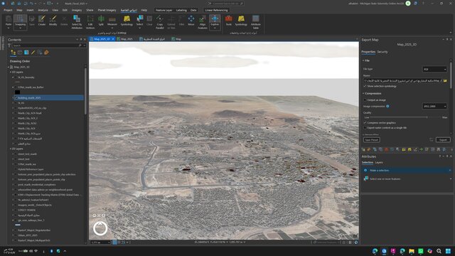

3D Urban GIS Model and City Visualization Using ArcGIS Pro

Developed a 3D urban GIS model integrating buildings, roads, terrain,
and satellite imagery within an ArcGIS Pro local scene.
The work included preparing urban feature layers, aligning spatial data
with the terrain surface, configuring building extrusion and elevation,
and applying suitable symbology for clear city-scale visualization.
The resulting model supports urban visualization, spatial exploration,
planning presentations, and assessment of relationships between the
built environment, transportation network, and surrounding terrain.
Published